

You're now following
Error following user.
This user does not allow users to follow them.
You are already following this user.
Your membership plan only allows 0 follows. Upgrade here.
Successfully unfollowed
Error unfollowing user.
You have successfully recommended
Error recommending user.
Something went wrong. Please refresh the page and try again.
Email successfully verified.

pilimathalawa, sri lanka
It's currently 4:51 PM here
Joined September 30, 2019
0 Recommendations
Jagath Kumara Jayaweera K.
@jagathjayaweera8
0.0
0.0
100%
100%
pilimathalawa, sri lanka
N/A
Jobs Completed
N/A
On Budget
N/A
On Time
N/A
Repeat Hire Rate
Gis Technician/Cartographer/Remote Sensing Analyst
Contact Jagath Kumara Jayaweera K. about your job
Log in to discuss any details over chat.
Portfolio
Portfolio
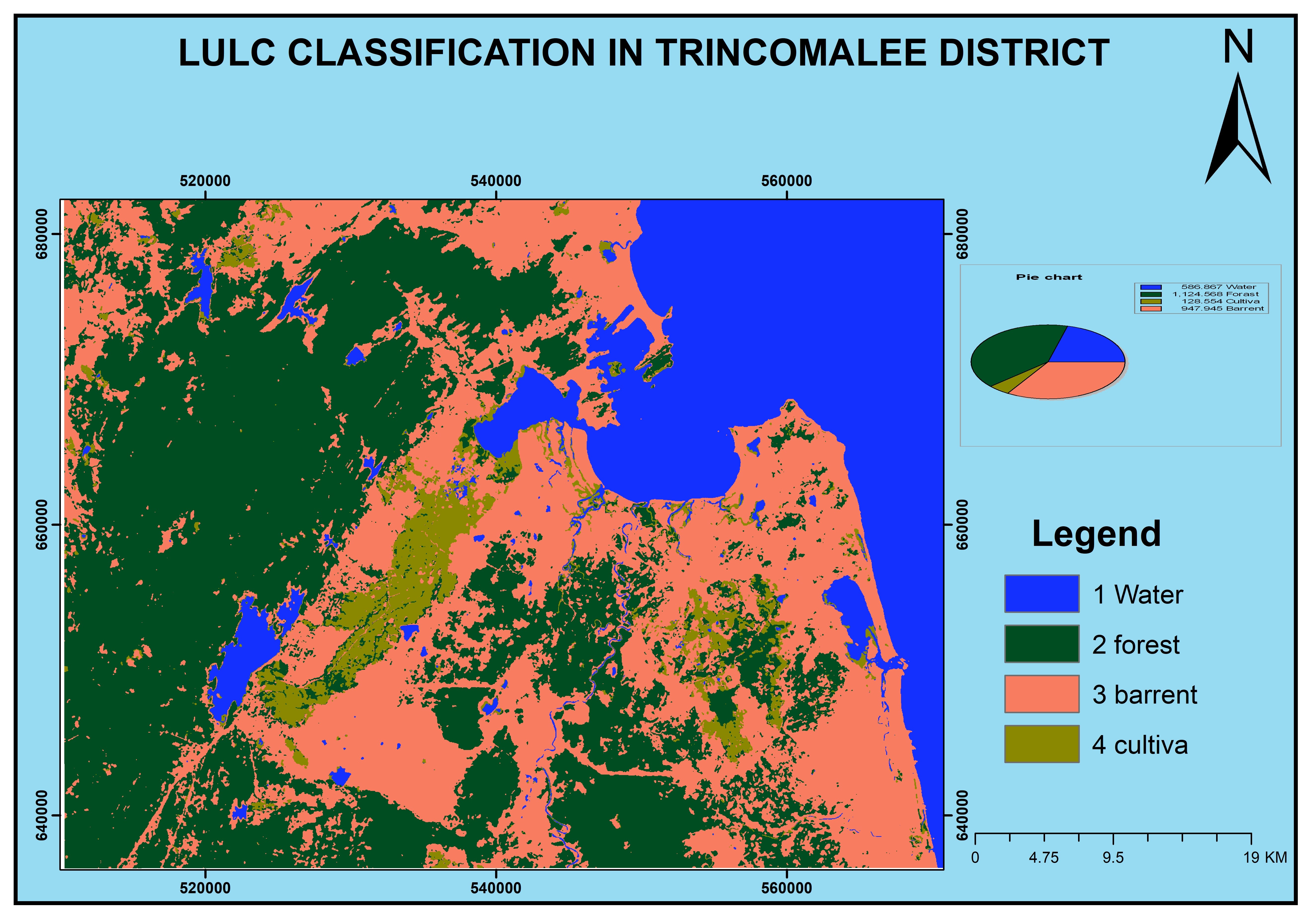

Land Use Land Cover (LULC) Map
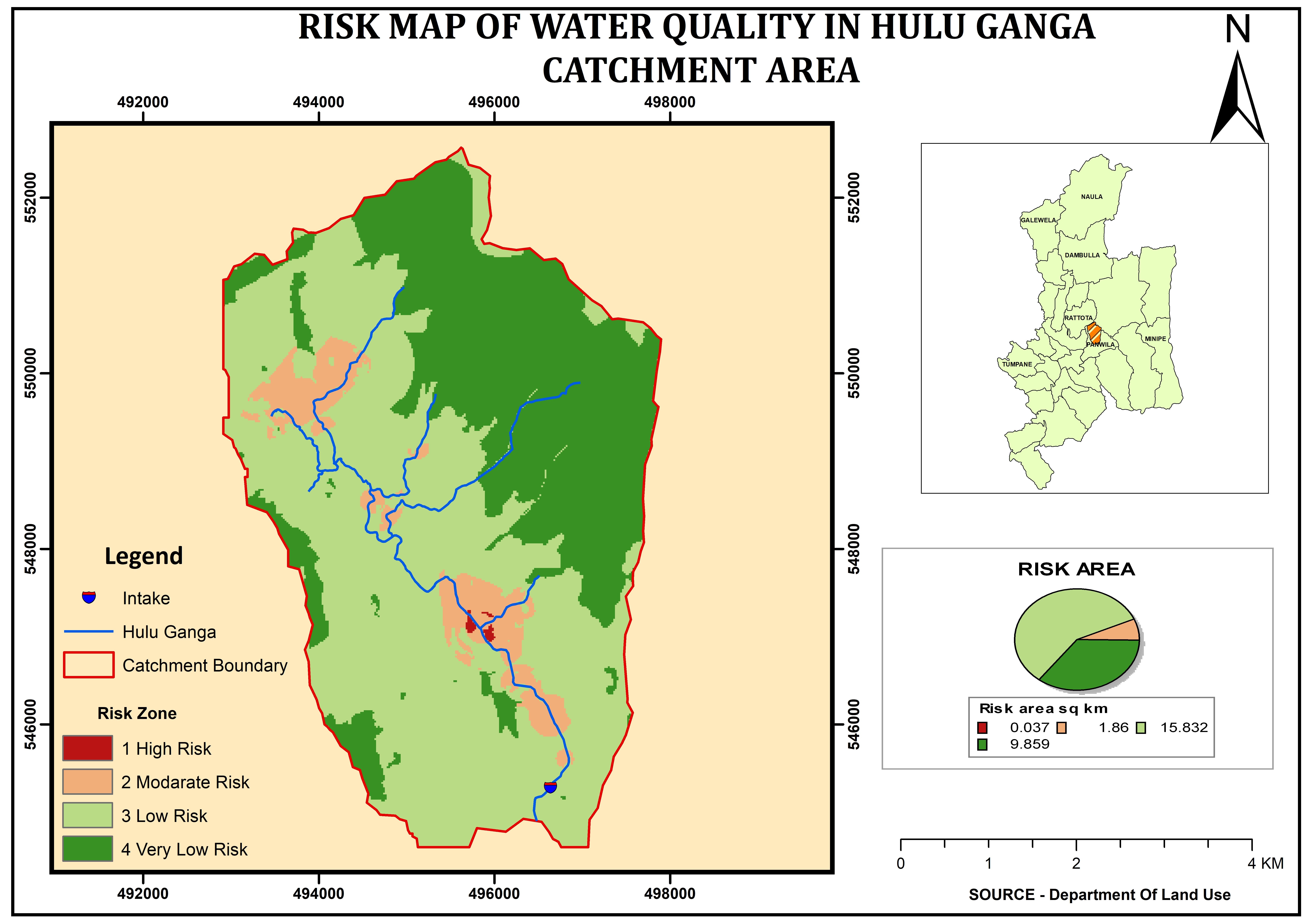

Suitability Analysis
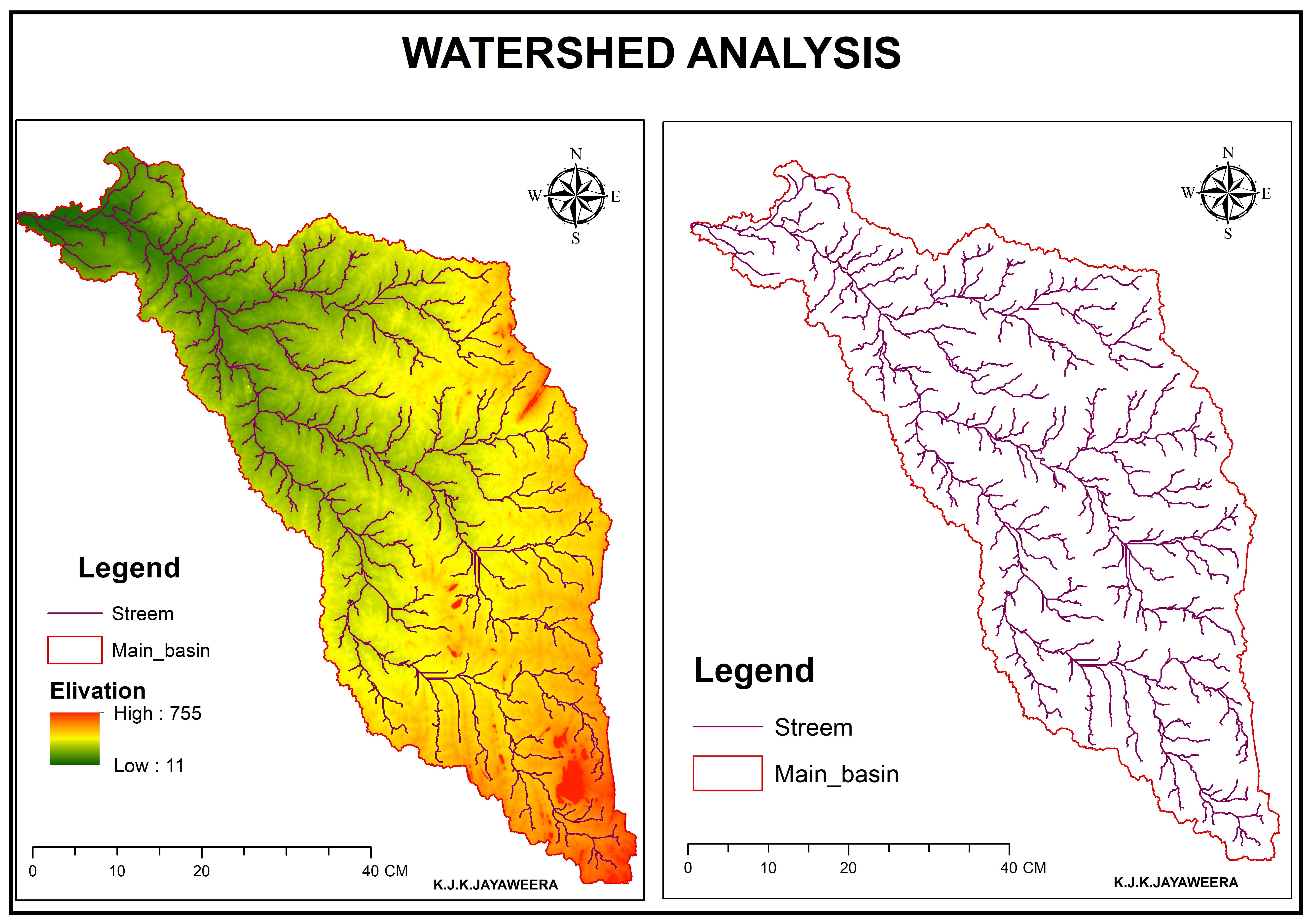

Watershed Delaminate.


True color combination and false color combination map
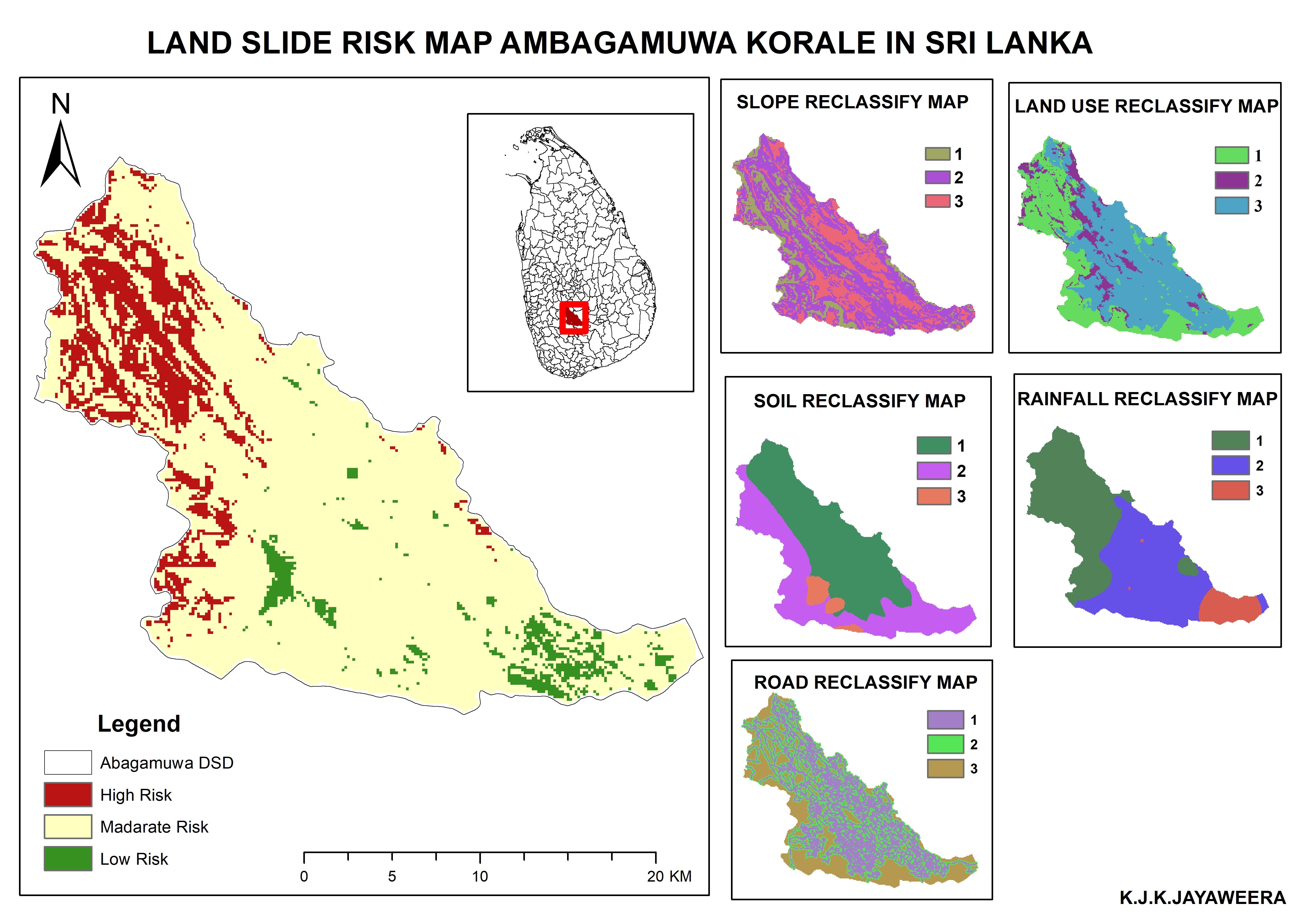

landslide Risk map ambagamuwa korale in sri lanla


Bevolkingsspreiding Zodi - America AL 200A
Land Use Land Cover (LULC) Map
Suitability Analysis
Watershed Delaminate.
True color combination and false color combination map
landslide Risk map ambagamuwa korale in sri lanla
Bevolkingsspreiding Zodi - America AL 200A
Reviews
Changes saved
No reviews to see here!
Experience
Engineering Assistant
Feb 2007 - Present
* GIS mapping work,
* Handling high accuracy GPS,
* Feasibility work of proposed projects (Demand survey, land acquiring taking flow measurements using surface water flow
meter in Streams, Taking LS Using GPS)
* Watershed analysis
* Raster image analysis.
Education
certificate of Geospatial Technology Applications in Hydrology and Water Resources. (IIRS)
(Less than a year)
Diploma in GIS & Remote Sensing
(2 years)
Advanced Diploma in Construction
(2 years)
Qualifications
Diploma In Quantity Surveying
CHPB
2019
Diploma in QS
Contact Jagath Kumara Jayaweera K. about your job
Log in to discuss any details over chat.
Verifications
Top Skills
Browse Similar Freelancers
Browse Similar Showcases
Invite sent successfully!
Thanks! We’ve emailed you a link to claim your free credit.
Something went wrong while sending your email. Please try again.
Copy to clipboard failed, please try again after adjusting your permissions.
Copied to clipboard.
Loading preview
Permission granted for Geolocation.
Your login session has expired and you have been logged out. Please log in again.